 Wilson Peak (14,017')
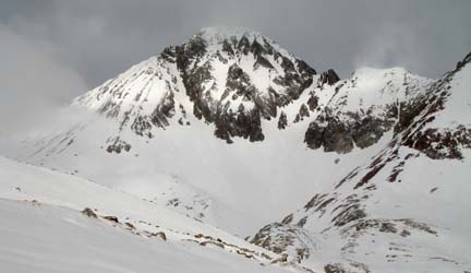
Saturday, February 10th After setting up our high camp and our climb of Gladstone Peak the previous day we were in no hurry to get rolling and slept in until around 7am. It had been a breezy night with intermittent snow pellets pounding the tent but nothing serious. I poked my head out of the tent and noticed the cloud deck was low enough to obscure the summits of Gladstone and the surrounding peaks. But the temperature was warm and the forecast for cloudy but stable weather seemed to be holding true. For a moment Cynthia and I discussed bailing on the attempt of Wilson Peak but I don't believe either of us was actually serious about that idea. So it was on! I heated up some water for drink and hot cereal (thanks to Cynthia for the nicely compiled granola/raisin/powdered milk cereal), we packed up and left the camp around 8:15am. Our plan was to descend from camp to about 11,400' and make an ascending traverse around the low end of Gladstone's east ridge to gain what appeared on the map to be a nice bench in upper Bilk Basin and then eventually reach the base of Wilson Peak's south face around 12,900' before climbing straight up the face to intersect the west ridge around 13,800'. From there we'd take the west ridge to the summit. The ascending traverse around the lower end of the Gladstone's east ridge worked out nicely despite being a bit steep and hardpacked in places. That made it hard for me to skin up on my splitboard and I'm sure wasn't too enjoyable for Cynthia on her snowshoes. But alas it was over quickly and we soon found ourselves on a nice flat bench looking into upper Bilk Basin. 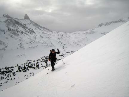 Cynthia traversing the lower end of Gladstone's east ridge at about 11,700'. Our high camp is just below the saddle in the background.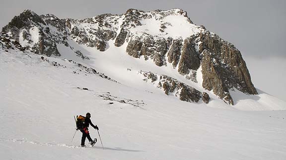 Making tracks on the nice bench around 11,900' in Bilk Basin just north of Gladstone's east ridge.We did one more steep, ascending traverse of a slope I wasn't particularly pleased about (due to depth hoar lurking below the six inch crust surface) but it was over quickly and without incident. At 12,900' we were looking straight up the south face of Wilson Peak and were very encouraging with what lay ahead. Looking higher into the basin we could see the well-preserved cabin perched at the head of Bilk Basin. Here we opted to stash the snowboard and snowshoes and bust out the crampons and ice axes for the remainder of the climb. Off we went following a line of great step-kicking snow up the south slope. 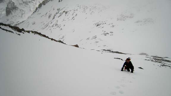 Working on up the south slope of Wilson Peak.I optimistically hoped we had reached the ridge above always-entertaining "north side traverse" of the standard route but after ascending the ridge for a couple of minutes we found ourselves peering down into the notch that marked the start of this little traverse. D'oh! I've been through this section in spring, fall and now winter, and it's alway an attention-getter! This time was no exception. Cynthia proclaimed we must carry on and so it was. I started down first face-in and kicking steps into the snow and feeling for good rock with the front-points of my crampons. This carried on until we were well into the notch and then traversing east slowly groping for holds on rock and feeling for foot placements. It took us about 40 minutes to go the final 100' vertical to the summit but we were there at 1:30pm and stoked! 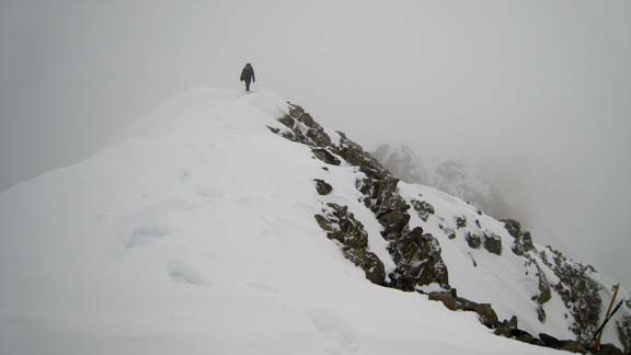 Cynthia walking the final bit of ridge to the summit. Note the tent-poles cross adorning the summit area in the lower right portion of the photo.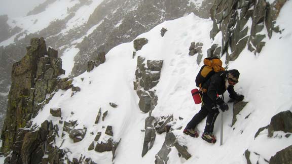 In the notch of the north-side traverse. Check those hand holds and steps!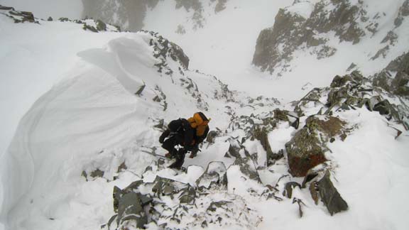 Exiting the notch on the return.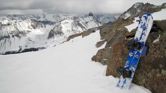 Ah yes, getting ready for some riding.That night we hit the sacks around 8:00pm just as it really began to snow in earnest. It snowed all night and when we got up at 6:00am, there was close to 10 inches of new snow on the ground! 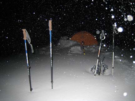 Sunday morning--new snow!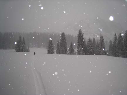 Starting the hike out in the drab, hard to see conditions.
Written by Jason Halladay on 12 Feburary 2007 for TheMountainInstitute.com.
|